
Sunday, August 07, 2005
7Springs PreRide ReCap
Okay no more crying about a few (thousand) thorns... First I'll give a description for those that rode the race before :
The switchback descent and climb on the front side of the course is gone. The worst (lower middle) of the backside climb is gone. I still got 1600+ feet of climbing on my Polar but will verify that later when I get the GPS map up. The course is the basically the same length as a new section was added.
The race link and their latest map. You can pick up a large printed map at the bike shop which is at the right end of the main parking lot up the stairs near the amphitheater. I talked to one of the guys there who had been out marking the course for a while. Then as I left he said "Good luck out there" Hmmmmmmm makes ya' wonder.
Other stuff :
First I rode a few laps on my FS Epic with Kenda Kharisma UST 2.1's at 38 psi. The course was VERY dry and the tires worked great. I kept thinking that these rocks would get pretty slippery with a little rain. Then it rained! Not hard - just a drizzle enough to make that layer of dust on the rocks like slime. SO those tires worked great early in the dry, and as good as any after a slight rain. Anything would've slipped at that point.
Then I did a lap on my 29er SS. If you rode this years 24 hours of Big Bear use the same ratio, it'll work just fine. I think this course actually has more climbing per lap than Big Bear, but the traction here is much better, and the average pitch overall is probably less. The last climb at the Springs after you turn off the road is the steepest, but again the traction is there, even though my legs weren't. I had to push my RIG up that hill even with a wimpy 22t (hey I could've lied and said it was an 18!) cog on it. (I'm really not a wuss, just a fat old broccoli fed flatlander). The downhills are all steep enough that your brakes will limit your speed, not your SS gearing - except the first long traverse on the back side and on the flat lap around the lake, - you could potentially make up some time running a higher gear (smaller cog) .
 The start and first sections of the race remain unchanged other than having to get through a massive construction project at the top of the hill between the far side of Lake Tahoe and the Wagner lift. This is not marked as yet, I'm sure they'll wait till the last minute to do so.
Enter the single track at the same place off of Pitts Distillery Road. Single track? maybe 1/2 track! They're won't be any passing here!
The same twisty single track as last year (one small reroute) all the way across the road and into the rock garden. More like a full fledged rock nursery. Upon leaving the nursery you go left and stay high on the mountain (not right and down hill like last year). Go between the lakes behind Wagner lift and rejoin last years course just on the high side of Fawn Lane ski trail.
Sing along now: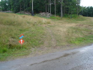
"Across the road and into the woods up to the lake we go"
A hint on following the course :
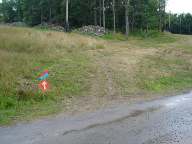
Look for those white arrows with the orange background. If you see red and an orange plain arrow (no background) follow the red one.

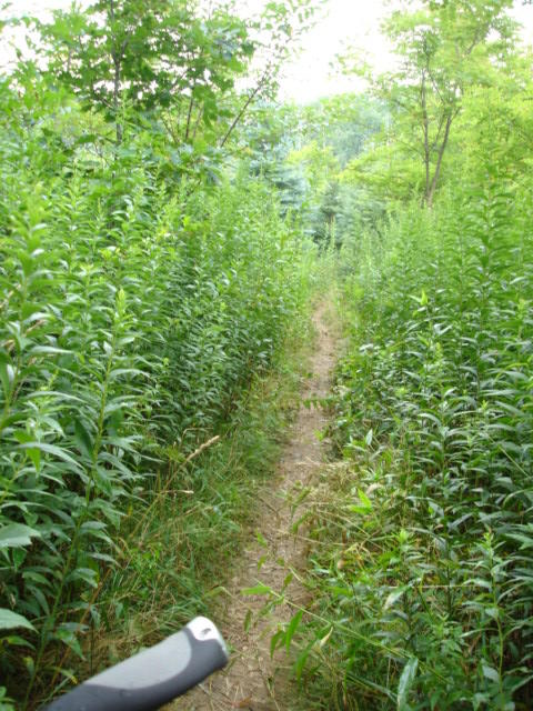
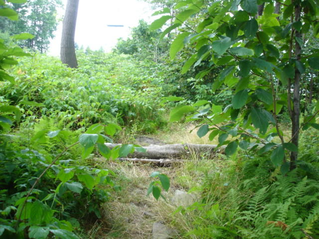
The trail here again is tight and overgrown, with those dam overhanging bloodthirsty thorns, woops I said I wouldn't bring those up again.

Then the course is the same as last year. Out onto the field around the lake, along the edge of the construction site into the single track. This starts a very fast and fun section of the trail (except for those .....) .
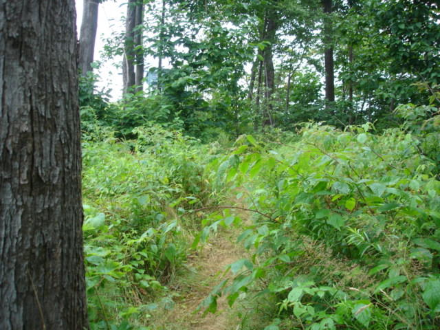
 This is the beginning of a new loop toward the end of mile 7 that is not indicated on the new map. It is well labeled fresh cut single track and easy to follow. Basically about 1/3-1/2 mile climb followed by nice descent. It comes out across the road where the Aid station was last year which is the lowest point of elevation on the course.
The switchback descent and climb on the front side of the course is gone. The worst (lower middle) of the backside climb is gone. I still got 1600+ feet of climbing on my Polar but will verify that later when I get the GPS map up. The course is the basically the same length as a new section was added.
The race link and their latest map. You can pick up a large printed map at the bike shop which is at the right end of the main parking lot up the stairs near the amphitheater. I talked to one of the guys there who had been out marking the course for a while. Then as I left he said "Good luck out there" Hmmmmmmm makes ya' wonder.
Other stuff :
First I rode a few laps on my FS Epic with Kenda Kharisma UST 2.1's at 38 psi. The course was VERY dry and the tires worked great. I kept thinking that these rocks would get pretty slippery with a little rain. Then it rained! Not hard - just a drizzle enough to make that layer of dust on the rocks like slime. SO those tires worked great early in the dry, and as good as any after a slight rain. Anything would've slipped at that point.
Then I did a lap on my 29er SS. If you rode this years 24 hours of Big Bear use the same ratio, it'll work just fine. I think this course actually has more climbing per lap than Big Bear, but the traction here is much better, and the average pitch overall is probably less. The last climb at the Springs after you turn off the road is the steepest, but again the traction is there, even though my legs weren't. I had to push my RIG up that hill even with a wimpy 22t (hey I could've lied and said it was an 18!) cog on it. (I'm really not a wuss, just a fat old broccoli fed flatlander). The downhills are all steep enough that your brakes will limit your speed, not your SS gearing - except the first long traverse on the back side and on the flat lap around the lake, - you could potentially make up some time running a higher gear (smaller cog) .
 The start and first sections of the race remain unchanged other than having to get through a massive construction project at the top of the hill between the far side of Lake Tahoe and the Wagner lift. This is not marked as yet, I'm sure they'll wait till the last minute to do so.
Enter the single track at the same place off of Pitts Distillery Road. Single track? maybe 1/2 track! They're won't be any passing here!
The same twisty single track as last year (one small reroute) all the way across the road and into the rock garden. More like a full fledged rock nursery. Upon leaving the nursery you go left and stay high on the mountain (not right and down hill like last year). Go between the lakes behind Wagner lift and rejoin last years course just on the high side of Fawn Lane ski trail.
Sing along now:
"Across the road and into the woods up to the lake we go"
A hint on following the course :
Look for those white arrows with the orange background. If you see red and an orange plain arrow (no background) follow the red one.
The trail here again is tight and overgrown, with those dam overhanging bloodthirsty thorns, woops I said I wouldn't bring those up again.
Then the course is the same as last year. Out onto the field around the lake, along the edge of the construction site into the single track. This starts a very fast and fun section of the trail (except for those .....) .
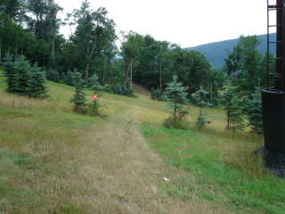
This is the beginning of a new loop toward the end of mile 7 that is not indicated on the new map. It is well labeled fresh cut single track and easy to follow. Basically about 1/3-1/2 mile climb followed by nice descent. It comes out across the road where the Aid station was last year which is the lowest point of elevation on the course. You come back into view of the ski slopes on some overgrown double track and exit (left) onto a road that is fast but short. Turn up the mountain like last year, but where it levels out a bit (before the first very steep section from last year) you turn left and start a nice long fast slightly downhill traverse across the slopes.
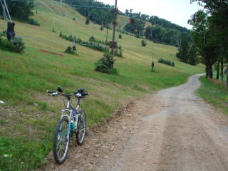 The traverse dumps you out on the road where you start a gravel road climb. The photo is looking back.
 As the top nears you go right for another (shorter and slower) traverse which joins up with the last portion of last years climb. Two straight stretches up a gravel road then off the road to the right up the steepest part of the climb. Thats it! Now repeat as needed.
JB
Comments:
Post a Comment
<< Home

<< Home
![]()


